Obtain your FAA Part 107 Remote Pilot Certificate before flying any drone commercially for real estate drone photography in NYC—this federal requirement carries penalties up to $32,666 per violation. Register your drone with the FAA if it weighs between 0.55 and 55 pounds, costing just $5 and taking minutes online. Secure airspace authorization through LAANC (Low Altitude Authorization and Notification Capability) before every flight, as nearly all of NYC falls within Class B controlled airspace surrounding major airports where drone flights are heavily restricted. Contact local property owners and building management for written permission when photographing real estate, since NYC also prohibits takeoffs and landings from public property including streets, sidewalks, and parks. Beyond federal aviation rules, you must navigate city-specific regulations that make NYC one of America’s most challenging locations for drone operations. Whether you’re a photographer expanding services or exploring property investment strategies that include aerial marketing, understanding these requirements protects you from substantial fines while ensuring safe, legal operations. This guide breaks down the essential permits, geographic restrictions, and step-by-step compliance processes you need to operate drones legally in New York City’s complex regulatory environment.
Why NYC’s Drone Laws Are Different (And Stricter)
New York City operates under a uniquely strict drone regulatory environment that combines federal oversight with local ordinances, creating what many consider the most restrictive drone laws in the United States. Understanding why requires looking at the city’s distinctive characteristics and security concerns.
At the federal level, the FAA controls all airspace above the city, just like anywhere else in the country. However, NYC presents exceptional challenges. The city sits beneath some of the nation’s busiest flight corridors, with three major airports (JFK, LaGuardia, and Newark) creating overlapping controlled airspace zones that cover virtually the entire metropolitan area. This means almost any drone flight requires coordinating with air traffic control, something most recreational or even commercial operators aren’t equipped to handle.
Beyond federal rules, New York City has enacted its own regulations through the NYC Administrative Code. The city prohibits drone takeoffs and landings in all public spaces, including parks, streets, and sidewalks, unless you have explicit written permission from the property owner or managing authority. This effectively eliminates most convenient launch locations for real estate photography within city limits.
The reasoning behind these restrictions centers on public safety and security. With a population density exceeding 27,000 people per square mile in Manhattan, a falling drone poses significant risks. The city also hosts countless high-profile locations, government buildings, and critical infrastructure that require enhanced security measures. Post-9/11 sensitivities mean authorities take unauthorized aircraft, including drones, extremely seriously.
For real estate photographers, this creates a practical reality: what’s legal and straightforward in suburban areas becomes complex or impossible in NYC. Most professional drone operators working legally in the city either operate from private property with explicit permissions or use helicopter-based photography instead. The consequences of ignoring these rules include fines up to $400 for city violations, plus potential federal penalties and confiscation of equipment.
What You Need Before You Launch: Licenses and Permits
The FAA Part 107 License Explained
If you’re planning to use a drone for real estate photography in NYC—even casually—you need an FAA Part 107 license. This isn’t optional. The Federal Aviation Administration requires this commercial drone license for anyone flying a drone for business purposes, including property listings, inspections, or promotional content.
Here’s what getting your Part 107 involves. First, you must be at least 16 years old and pass a 60-question knowledge test at an FAA-approved testing center. The exam costs $175 and covers airspace regulations, weather effects on flight, emergency procedures, and drone operation rules. Most people spend 10-20 hours studying using FAA-provided materials or online courses, many of which are free or under $200.
The test itself isn’t impossibly difficult, but it requires real preparation. You’ll need to understand sectional charts (aviation maps), recognize different types of airspace, and know when you can and cannot fly. The pass rate hovers around 90% for those who study properly.
Once you pass, your license arrives within 6-8 weeks and remains valid for two years. Total investment? Around $175-$400 depending on study materials, plus your preparation time.
Why is this non-negotiable for real estate work? Operating without a Part 107 can result in civil penalties up to $27,500 per violation. Insurance companies won’t cover unlicensed operators, and professional clients rightfully expect proper credentials. In NYC’s heavily regulated airspace, flying without proper licensing adds legal risk you simply cannot afford. Think of it as the baseline credential—not a suggestion, but a requirement before you even consider launching.
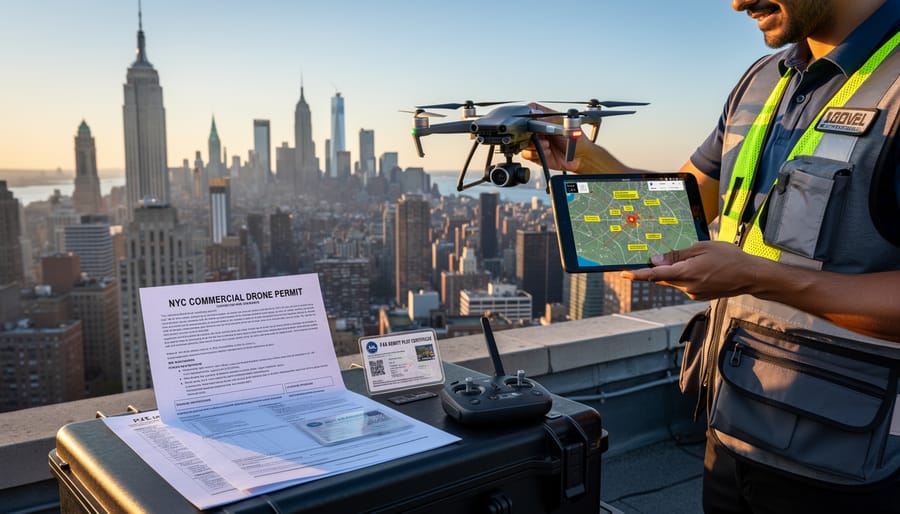
NYC-Specific Permits You Can’t Skip
Beyond federal FAA approval, New York City requires additional permits that many drone operators miss—and these oversights can result in immediate shutdowns of your shoot.
For any drone operation in NYC parks, you need a permit from the NYC Parks Department, even if you have FAA authorization. This applies whether you’re photographing a brownstone near Prospect Park or capturing aerial shots of properties adjacent to Central Park. The Parks Department reviews applications based on public safety, environmental impact, and the nature of your project. Processing typically takes 4-6 weeks, so plan accordingly. Without this permit, park rangers can stop your operation regardless of your other credentials.
Commercial photography and videography, including real estate drone work, requires coordination with the Mayor’s Office of Media and Entertainment (MOME) and often an NYPD permit. If your drone shoot involves any commercial purpose—meaning you’re being paid or the footage supports a business transaction like a property listing—you fall under this requirement. The application process asks for specifics about your flight plan, insurance coverage, and safety protocols. MOME permits cost between $300-$600 depending on location and scope.
For shoots on private property, you’ll need written permission from the property owner or building management. Co-op and condo boards often have specific rules about drone operations, so don’t assume the seller’s permission is enough. Document everything in writing.
Street closures or operations affecting public spaces may require additional NYPD coordination, particularly in high-traffic areas like Midtown or Lower Manhattan. These applications can take 2-3 weeks for approval.
The bottom line: budget at least 6-8 weeks for the complete permitting process before your planned shoot date, and expect to pay $500-$1,000 in combined fees for commercial real estate work.
Where You Can (and Absolutely Can’t) Fly in NYC
Reading the Airspace Map
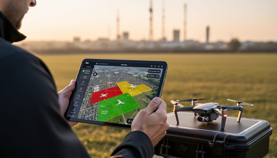
Before launching your drone for NYC property photography, you need to understand exactly where you can and cannot fly. The airspace above New York City is complex, with multiple overlapping restrictions that change frequently.
Start with the B4UFLY app, the FAA’s free mobile tool available for iOS and Android. After downloading, enable location services and zoom into your property’s address. The app displays color-coded airspace: red zones indicate prohibited areas where drone flight is banned, yellow zones show controlled airspace requiring authorization, and green zones mark areas generally safe for recreational flight. However, even green zones may have restrictions in NYC due to local laws.
When you open B4UFLY for a typical Manhattan property, you’ll likely see yellow or red coloring. This indicates proximity to controlled airspace around LaGuardia, JFK, or Newark airports. The app will show the specific restriction and whether you need LAANC authorization (Low Altitude Authorization and Notification Capability) to proceed.
For professional photographers, the FAA’s online airspace map at faa.gov/uas provides more detailed grid information. Look for UAS Facility Maps showing maximum altitude limits in different zones around airports. Some NYC areas permit flights up to 50 feet, while others allow 200 feet or prohibit flights entirely.
Check for Temporary Flight Restrictions (TFRs) that pop up for events, VIP movements, or emergencies. B4UFLY updates these in real-time, but also verify on the FAA’s TFR website before each flight. Missing a TFR can result in immediate legal consequences, regardless of other permissions you’ve obtained.
Parks, Public Spaces, and Private Property Rules
New York City maintains strict regulations for flying drones over its public spaces, and understanding these rules is essential for anyone planning aerial real estate photography. The NYC Parks Department prohibits drone takeoffs, landings, and flights within all city parks without explicit written permission. This means Central Park, Prospect Park, and over 1,700 other parks are off-limits for recreational and commercial drone operations unless you’ve secured special authorization, which is rarely granted.
Flying over public streets and sidewalks presents additional challenges. While not explicitly banned by city ordinances, federal FAA regulations still apply. You must maintain visual line of sight, stay below 400 feet, and never fly directly over people not involved in your operation. For real estate photographers, this effectively eliminates most street-level launches in densely populated neighborhoods.
When it comes to private property photography, you face a dual-layer challenge. First, you need the property owner’s permission to photograph their building. Second, you cannot legally fly your drone over neighboring properties without their consent, as property owners have reasonable expectations of privacy and airspace rights. This becomes particularly complicated in NYC’s tightly packed residential areas where buildings stand mere feet apart.
Community feedback from real estate photographers consistently emphasizes the importance of getting written permission from all affected property owners. One photographer noted receiving a cease-and-desist letter after neighbors spotted their drone, even though they had the subject property owner’s approval. Always document your permissions and notify surrounding residents before flying to avoid legal complications and maintain good community relationships.
Height Limits and Visual Line of Sight Requirements
Federal regulations cap drone flight at 400 feet above ground level, but NYC’s towering skyline creates unique challenges for this rule. When photographing properties, you must stay below 400 feet measured from the ground directly beneath your drone, not from your takeoff point. This becomes tricky around skyscrapers—if you’re shooting a 30-story building, you cannot fly above its roof to capture aerial views, even if that roof exceeds 400 feet.
Visual line of sight is non-negotiable. You must maintain direct, unaided visual contact with your drone at all times during flight. This means no binoculars, monitors-only operation, or flying around building corners where you lose sight. For real estate photography, this practically limits your operating distance to roughly 1,500-2,000 feet depending on conditions.
In dense urban environments, tall buildings also create wind tunnels and signal interference. Always conduct a site survey before your shoot to identify potential obstacles. If you’re photographing a brownstone in Brooklyn with clear sightlines, compliance is straightforward. Shooting a high-rise in Midtown requires careful planning to maintain visual contact while respecting altitude limits and avoiding restricted airspace that often surrounds these areas.
Real-World Setup: Getting Your Real Estate Drone Shot Legally
Pre-Flight Checklist and Authorization Process
Before you launch your drone at any NYC property, completing a thorough pre-flight checklist isn’t just good practice—it’s essential for staying compliant with local regulations and avoiding penalties.
Start with LAANC authorization, which stands for Low Altitude Authorization and Notification Capability. This FAA-approved system provides near-instant authorization to fly in controlled airspace around NYC’s airports. Download a LAANC-enabled app like Aloft or AirMap, enter your flight details including location, altitude, and time, and submit your request. Most approvals come through within seconds, though complex airspace may require manual review taking several days.
Next, check NOTAMs—Notices to Airmen—which alert pilots to temporary flight restrictions. The FAA’s website and aviation apps display active NOTAMs for your intended flight area. These notices cover everything from presidential visits to stadium events, and violating them carries serious consequences.
Property coordination is equally critical. Obtain written permission from the property owner before flying, even if you’re the listing agent. This documentation protects you legally and professionally. Notify immediate neighbors about your flight plans, explaining the purpose and approximate timing. This courtesy prevents complaints and potential police calls that could shut down your shoot.
Finally, verify weather conditions and conduct a physical site inspection. Check for power lines, tall trees, and other obstacles that might not appear on digital maps. Document your authorization approvals and keep them accessible on-site—inspectors or law enforcement may request proof of compliance during your operation.
Day-of-Shoot Compliance and Documentation
When you arrive at your shooting location, proper documentation protects you from fines and misunderstandings. Before launching, photograph or screenshot your Part 107 certificate, FAA authorization documents, and any city permits. Keep digital and physical copies accessible on your phone and in your equipment bag. These records prove compliance if questioned.
Document your pre-flight checklist in writing. Note the time, location coordinates, weather conditions, and airspace confirmation. Many professional drone pilots use simple apps or paper logs for this purpose. This creates a paper trail showing you took reasonable precautions, which matters if issues arise later.
If security personnel or property managers approach you during a shoot, remain calm and cooperative. Immediately offer to show your credentials and explain you have proper authorization. Never argue or continue flying if asked to stop. Sometimes building management wasn’t informed about approved flights, even when permits are valid. Politely provide your documentation and contact information for their records.
When law enforcement arrives, land your drone immediately and keep your hands visible. Explain you’re conducting authorized commercial photography and present your Part 107 certificate first, then any LAANC or FAA authorizations. Officers may not be familiar with drone regulations, so patience helps. Never fly away or attempt to leave the scene, as this escalates the situation unnecessarily.
If you encounter unexpected restrictions like temporary flight restrictions due to VIP movements or emergency operations, land immediately and postpone your shoot. Violating these restrictions carries serious federal penalties. Check NOTAM updates throughout your shooting day, not just during pre-flight planning. Weather changes, security concerns, or special events can create last-minute airspace closures that weren’t present when you started.

The Real Costs of Breaking the Rules
Breaking drone regulations in New York City isn’t just a minor mistake—it comes with serious financial and legal consequences that can impact your business or hobby for years to come.
The Federal Aviation Administration can impose civil penalties up to $27,500 for violations of FAA regulations. If you’re operating commercially without the required Part 107 license, you’re looking at potential fines starting at $1,100 per violation. New York City adds another layer of penalties, with local violations carrying fines ranging from $1,000 to $10,000 depending on the severity.
Criminal charges are also possible in serious cases. Reckless drone operation near people, buildings, or airports can result in criminal prosecution, especially if your drone causes property damage or injuries. In 2021, a Brooklyn resident faced criminal charges after their drone struck and damaged a residential window, demonstrating that authorities take enforcement seriously.
Your insurance won’t cover illegal operations either. Most liability policies explicitly exclude coverage for unlicensed commercial activity or violations of local laws, leaving you personally responsible for any damages or legal costs.
Recent enforcement examples show the city means business. The NYPD has confiscated drones from unauthorized operators in Central Park and near major landmarks. One real estate photographer lost both their drone and paid a $7,500 fine for unauthorized photography over residential properties in Manhattan.
For real estate photography specifically, using drones illegally can also expose you to civil lawsuits from property owners or neighbors who claim privacy violations or property devaluation. The risk simply isn’t worth cutting corners on compliance.
Alternatives When Drone Photography Isn’t Possible
When drone photography isn’t feasible due to NYC’s strict airspace restrictions, several practical alternatives can still capture impressive property images. Professional photographers commonly use elevated photography techniques with telescoping poles that extend 20-30 feet, providing higher vantage points without aircraft regulations. These poles mount cameras remotely controlled from ground level, offering angles that showcase rooftops and surrounding neighborhoods.
Cherry pickers and boom lifts represent another effective solution, particularly for luxury property listings. Rental companies throughout NYC provide various lift heights, though you’ll need proper permits for street placement and an experienced operator for safety compliance.
Neighboring building access offers unique perspectives if you can secure permission from adjacent property owners. Many photographers successfully negotiate rooftop access for specific shoot times, creating compelling angles that highlight your property’s context within the neighborhood.
Ground-based photography with wide-angle lenses remains reliable, especially when combined with strategic staging and professional lighting. While these alternatives require more planning than drone flights, they completely eliminate permit complexities and airspace violations, making them practical choices for time-sensitive listings.
Understanding and following NYC’s drone laws isn’t just about avoiding fines—it’s about protecting yourself, your clients, and everyone around you. Before investing in proper equipment, take time to thoroughly research the regulations that apply to your specific situation. Start with obtaining your Part 107 certification, identify whether your property falls within restricted airspace, and secure all necessary permissions from the FAA and local authorities. Remember that drone regulations are constantly evolving as the technology becomes more widespread. What’s legal today might require additional permits tomorrow, so make it a habit to check for updates regularly. Join online communities where drone operators share experiences and regulatory changes. The investment you make in understanding these rules will pay off far more than any expensive drone purchase. Legal compliance gives you confidence, protects your clients’ interests, and ensures your real estate photography business operates smoothly within New York City’s complex regulatory environment.
Related Posts
Post a Comment